One of the most important parts of bringing a story to life for me is to start with a map. I always get excited when I open a new book and find a detailed map inside. Getting a sense of the location helps orient me in the story. I want my own stories to have beautiful, detailed maps to guide my readers.
But I’m bad at drawing and even worse as a graphic artist. I make rough sketches for myself but they’re not ready for publishing.
I have experimented with mapmaking programs in the past but it’s difficult to get things looking the way I like. For Wyld Magic, I fell back on doing it by hand in Photoshop and, well, you may have already seen the result.
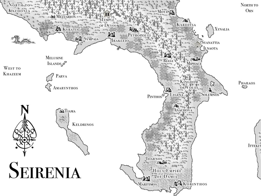
At least it’s mostly readable, if a little busy with the amount of texture I stuck all over it. But it needs work, and I plan on redoing it again someday.
I wanted more for the Empire of Arkia, the setting for the Divine Warriors series. So back to experimenting. I’ve been trying out a new program called Wonderdraft that’s pretty easy. I’m still learning all of the options.
But first, who wants embarrassing old sketches of Chelynne (the world), Arkia (the continent), and Lyndamon (the province)? I’ve been working on this world for over twenty years so I have a lot of old notes. They’re going to be a little blurry, sorry for taking pictures on my phone instead of properly scanning them.
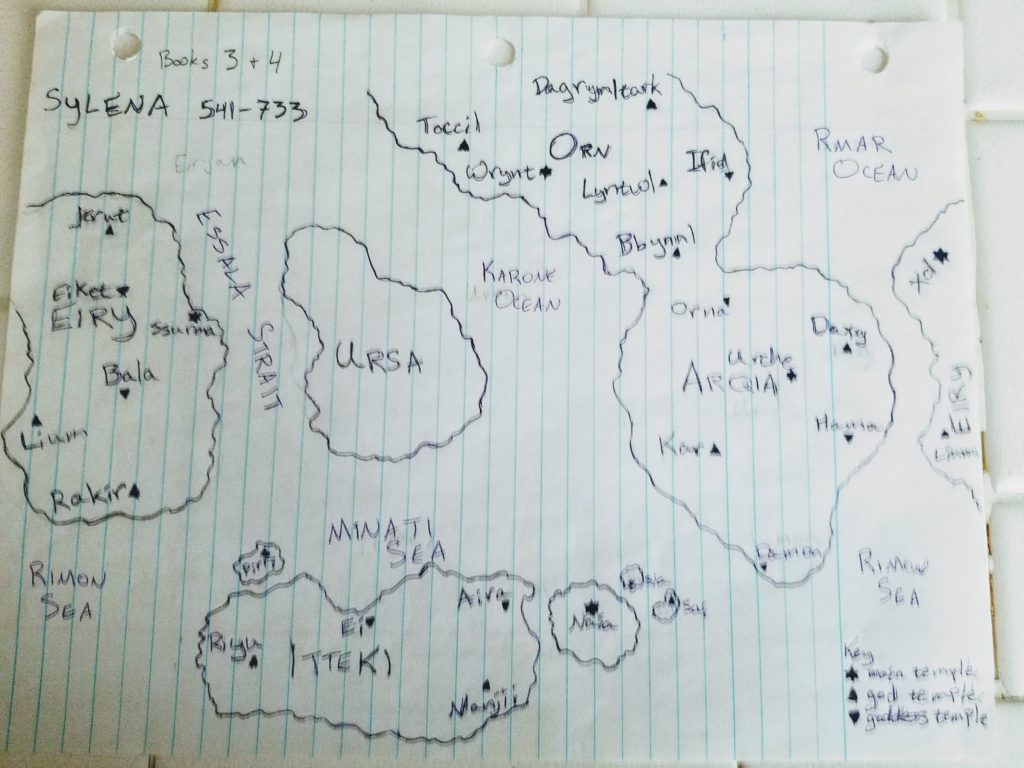
A map of the world, about 15 years old. This is traced from an older map that I can’t find right now. The continents and the major cities are labeled. It represents an older period in the world’s history. For example, some of the names changed over time.
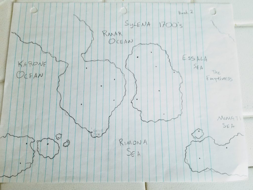
This map was drawn around the same time. I never finished putting it the labels. The planet is rotated so Arkia is in the middle. Also note that one of the continents is gone, replaced by “The Emptiness.” This relates to an old plot point that I’m not sure about revisiting now.
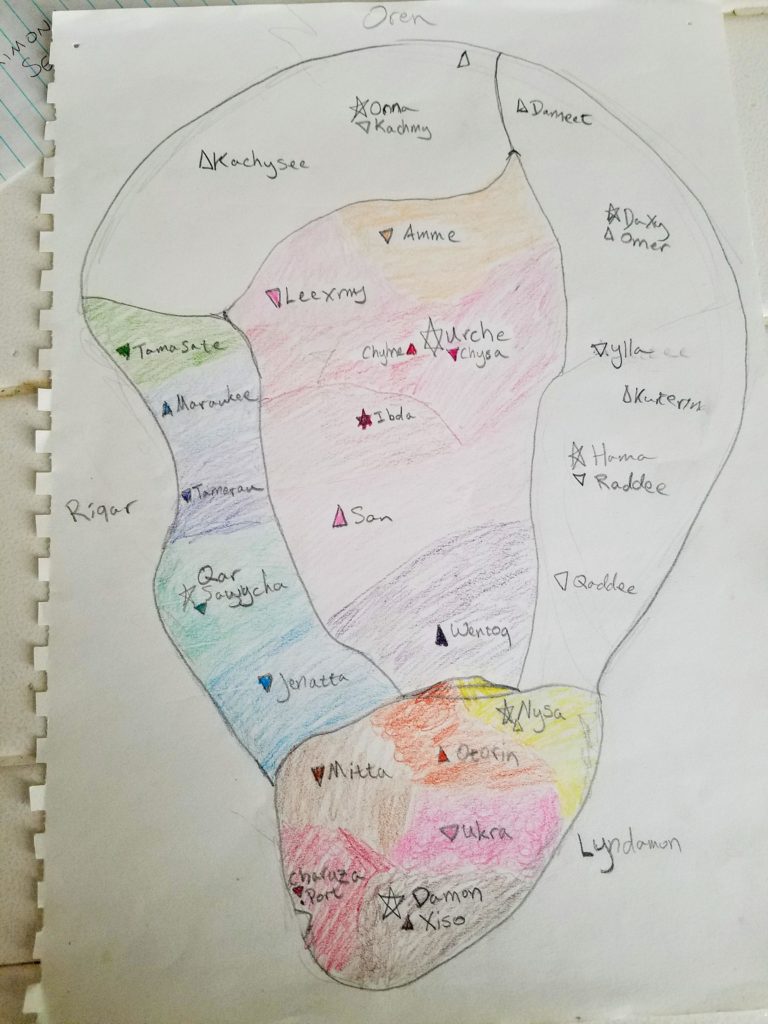
Here’s a map of Lyndamon that I was color-coding by region. The main cities are all filled in. You may notice that the provinces used to be in different locations. Lyndamon was in the south and its temple was dedicated to Xiso. I swapped it because I decided that Sawycha was more interesting for the start of the story.
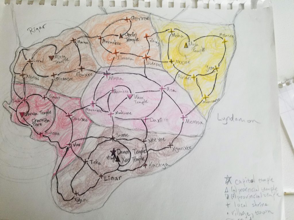
A map of just Lyndamon. Uses the same regional colors as the one above. The most detailed because all of the towns are marked along with the major roads connecting them. The darker swirls are supposed to show how far each temple’s influence reaches into the outlying settlements.
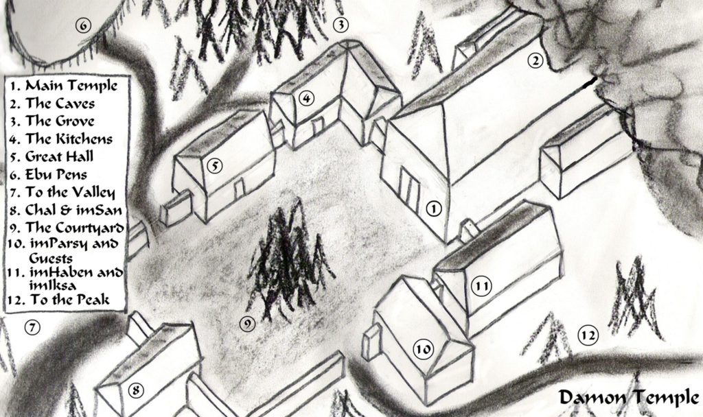
This is an old version of Damon Temple, the capital of Lyndamon. It was originally a much more rural setting, on top of a mountain. Later, I switched to a city and discarded this. However, I did use this temple layout for a set of old ruins that Riwenne and her friends explore in book 2. They’ll learn something important in those caves leading from the main temple.
You may also notice that I used a lot more Arqan words on my map. I have a fairly detailed language for Arkia, but I realized it was too confusing to read when so many made-up words filled the story. For example, “chal” is the title for the head priestess, “san” is an assistant to the head priestess, “parsy” is senior priestess, “iksa” is a junior priestess, and “haben” is a novice. Imagine trying to keep all of those titles straight!
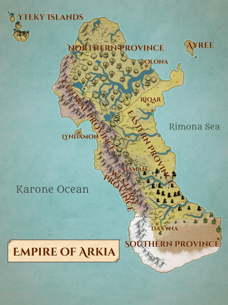
At last, here is the map I’ve been working on over the last weekend. I love all of the colors. It’s still a work in progress (I know that the text could be more readable, for example) but I’m pretty happy with how it’s coming along. For now, I’ve only labeled the capital cities for each region.
I’ll keep making adjustments and then I’ll drill down into regional maps, starting with the Central Province. I’ll also make a city map for Lyndamon. Look for a final version soon.
I hope you enjoyed seeing some of the evolution of my map and a sneak peek of what’s to come!
